
Location: 01 General : 1 Graphic Symbols
An incremental improvement to Elev Marker JAM8, which it replaces. The 'bending' is now handled by editing hotspots.
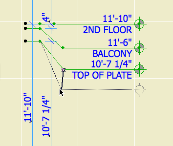
First spot: beginning of bend. Second spot: End and depth of bend. End spot: depth of bend and length of object.
Somewhere along the line I added the ability to display the elevation relative to sea level as well as project zero, without telling anyone, so now I've told you.