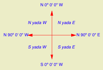
Isn't north up? Probably not. Since the orientation of the project is driven by the geometry of the plan, north can be any which way.

In the Sun dialog
Note: Though it's called 'Project' north, it's true north, in that it's the only north, and the north used by the sun settings. Archicad doesn't directly support a project north environment variable separate from true north.
There are at least four reasons to set project north correctly:
• Accurate sun shadows
• Automatic orientation of north arrow symbol objects.
• Automatic dimensioning of metes and bounds using the Survey Dim RND9 object.
• Correct naming of interior elevations with the Orientation autotext. (A real project north would be nice here.)
For the purposes of sun shadows and interior elevation names, you can eyeball the north direction by moving the pointer in the Sun dialog. A degree or two off isn't going to hurt.
For the metes and bounds to work, you need to set the direction exactly.
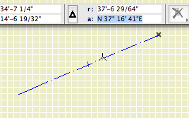
The easiest and best way is to use the surveyors' data. If you have a DXF or DWG, drop it into the floor plan window. It becomes a drawing. Rotate the drawing until it is lined up with the site boundary drawn in the project. You should be able to measure the angle of the surveyors' north arrow by placing the origin at one end, the cursor at the other end, and reading the angle (a) field of the coordinate box. Copy and paste this value into the Sun dialog.
If you don't have surveyor data, or if the they left the north arrow off, it's a bit trickier.
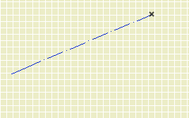
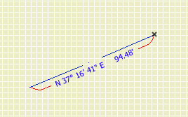
Draw the boundary polygon first. Pick one of the lines on the plat and note its angle. Let's say this line is supposed to be at N 37º 16' 41" E.
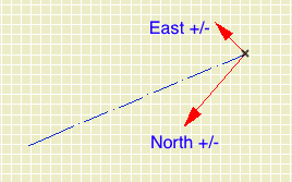
Convert the surveyors' angle to decimal degrees. You need to know that a minute is 1/60 of a degree or 0.0166667, and a second is 1/60 of a minute or 0.0002778. For our line this gives us 37º plus 0.2666672º plus 0.0113898º equals 37.278057º. That's the angle between our line and north in decimal degrees. Round the decimals to the fourth place.
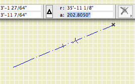
Add this value to the converted angle from before. The result for this example is 240.083º. (If the line was N something W, you would subtract.) Back in Archicad, you can draw a line at that angle starting from your origin, and that will be due north. But you don't need to draw the line, you just need to put the total value in the Sun dialog.
That's it. The north direction is not saved with views, so it should never change without you changing it. If you do change the rotation of the site relative to the building, you need to do your north over.
Here's a cheat sheet for figuring out how the surveyors' angles relate to the compass directions.
